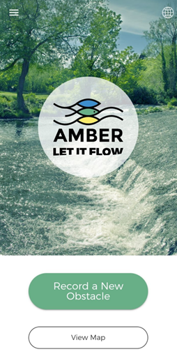
The free application Barrier tracker for iOS and Android was developed during the Amber Project and is used for field data collection on barriers.
The application is translated into Croatian and easy to use. When clicking on “Record a New Obstacle“, the user initiates the process of adding an obstacle to the database by uploading a photo and location of the obstacle. Other data, such as its type or height, are not obligatory, although they are desirable.
After the upload verification, the location of the barrier will appear on the app’s map and in the database on the website of the Amber Project (https://amber.international/european-barrier-atlas/). Finally, it will also appear in the future national database of obstacles, which will be created within the Improve River LIFE Project and made available to the public on the Bioportal (https://bioportal.hr/gis/).
The application can be downloaded at the following link:
https://play.google.com/store/apps/details?id=com.natural_apptitude.amber&hl=en&pli=1